An online project under the direction of the CAPE ANN MUSEUM
Historical Materials
Historical Materials » Gloucester Buildings & Businesses » Baptist Church (Second, 1851) (Pleasant Street)
Baptist Church (Second, 1851) (Pleasant Street)
View related Fitz Henry Lane catalog entries (5) »
Although in his 1852 Gloucester Harbor, Lane painted the Second Baptist Church to look like Italian brick, this building was in fact clad in New England clapboard, of an unknown but perhaps reddish color. It was the second Baptist church built in Gloucester, the first being just up Pleasant Street and visible in the same painting as the white steeple to the left. The second Baptist Church was designed by Gridley J.F. Bryant of Boston (the same architect who twenty years later would design Gloucester's City Hall) and was dedicated the year before, in March 1851. The minister at the time of the 1852 painting was Miles Sanford.
The church replaced a tavern on land directly across the street from Lane's childhood home. Lane never painted his old house, sold out of the family in 1839, but its location is often near the center of canvases of the harbor. In Gloucester Harbor, 1852 (inv. 38) painting at CAM, it was in the cluster of wooden houses partially covering the wall of the second Baptist church, to the right of the ship's mast. It was here that the young Nathaniel Rogers Lane played, ate the legendary and hypothetical "apple of Peru" to cause his lameness, learned the shoemaker's trade, and drew his early sketches of boats and sails. The site of the Lane house is now occupied by the old Gloucester Cooperative Bank building at 85 Middle Street.
This Baptist Church burned in December 1869, and was replaced in 1871 by the third Baptist church to stand on Pleasant Street, which in turn was torn down in 1966 to create a parking lot. But the large granite block used as its front step now forms the bottom of the pathway from the parking lot on Rogers Street up to the stone Fitz Henry Lane house.
Current address: Parking lot on Pleasant Street between Middle and Warren Streets, opposite the Cape Ann Museum.
– Sarah Dunlap (August, 2013)
44 x 34 in.
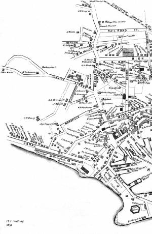
Henry Francis Walling, Map of the Towns of Gloucester and Rockport, Essex Co. Massachusetts. Philadelphia, A. Kollner, 1851
Cape Ann Museum Library & Archive
"Map of the Towns of Gloucester and Rockport, Massachusetts. H.F. Walling, Civil Engineer. John Hanson, Publisher. 1851. Population of Gloucester in 1850 7,805. Population of Rockport in 1850 3,213."


