An online project under the direction of the CAPE ANN MUSEUM
Historical Materials: Gloucester Buildings & Businesses
Historical Materials » Gloucester Buildings & Businesses » Old First Parish / Subsequent Fourth Parish Church (at the Green)
Old First Parish / Subsequent Fourth Parish Church (at the Green)
View related Fitz Henry Lane catalog entries (1) »
This church building at the Green was originally the First Parish Church but became the 4th parish (Town Parish) meeting house in 1752 (after the First Parish designation was taken by the 1738 church on Middle St.). The last service held in the church at the Green was on June 14, 1840, when it was feared the balconies would collapse. It was sold for demolition in Dec.1840, and torn down by William Ferson within 20 days of that. [Article in the GDT, Feb. 17, 1916, by Miss Babson for the weekly column from the Cape Ann Scientific and Literary Society.]
–Sarah Dunlap
Related tables: Meetinghouse Green » // Riverdale / Town Parish »
44 x 34 in.
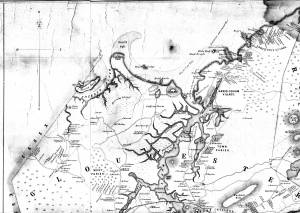
Henry Francis Walling, Map of the Towns of Gloucester and Rockport, Essex Co. Massachusetts. Philadelphia, A. Kollner, 1851
Cape Ann Museum Library & Archive
"Map of the Towns of Gloucester and Rockport, Massachusetts. H.F. Walling, Civil Engineer. John Hanson, Publisher. 1851. Population of Gloucester in 1850 7,805. Population of Rockport in 1850 3,213."
View related Fitz Henry Lane catalog entries (1) »
Also filed under: Annisquam River » // Babson House » // Coffin's Beach » // Eastern Railroad » // Gloucester, Mass. – Annisquam Harbor Lighthouse » // Granite Quarrying / Shipping » // Loaf, The » // Low (David) House » // Maps » // Riverdale Methodist Church (Washington Street) » // White-Ellery House »
