An online project under the direction of the CAPE ANN MUSEUM
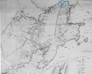
Folly Cove
View related Fitz Henry Lane catalog entries (1) »
Lane made a sketch of Folly Cove during a drive around Cape Ann with his friend Benjamin Champney. The resulting painting unfortunately has not survived.
Related tables: Champney, Benjamin »
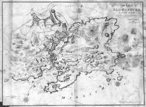
Lithograph
28.5 x 21 in.
Cape Ann Museum Library & Archive
When Massachusetts decreed that each town be mapped, John Mason drew the map of Cape Ann in 1830. This drawing was sent to the Senefelder Lithographic Company of Boston (owned by William Pendleton) to be printed, and then sold in Gloucester by W.E.P. Rogers, whose Gloucester Telegraph of February 12, 1831 announced, "A few specimen copies of the map, uncolored, have reached the town" and that they cost $1.25. Perhaps this business arrangement between Pendleton and Rogers provided Lane with his introduction to Pendleton.
Also filed under: Good Harbor Beach / Bass Rocks » // Maps » // Mason, John » // Meetinghouse Green » // Pendleton's, Lith. – Boston » // Salt Island » // Thacher Island »
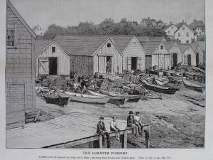
In G. Brown Goode, The Fisheries and Fishery Industries of the United States (Washington, DC: Government Printing Office)
Cape Ann Museum Library & Archive, Gloucester, Mass.
See pl. 249.
Lobster Cove (Lane's Cove) was a thriving port for the Ipswich Bay shore fisheries from colonial times through the 19th century. Even as late as the mid-20th century, the waterfront was lined with sheds for fishing gear - now all gone. In addition to lobstering, gill-netting, trap fishing, hand-lining, and seining (small-scale) were carried on at various times in pursuit of numerous fish and shellfish types.
– Erik Ronnberg
Also filed under: Lobstering »
Glass plate negative
4 x 5 in.
Cape Ann Museum Library & Archive
#10205/418
Also filed under: Lobstering »


